A map should answer a question
An isolated photograph may not explain entrances, roads, services, phases and landmarks. Choosing between 2D and 3D should begin with what the viewer needs to understand rather than which format looks more modern.
- Where is the development in relation to the city?
- How do people arrive from a recognizable road?
- How are lots, homes and amenities arranged?
- What changes between project phases?
- How does terrain affect the project?
When a 2D map works best
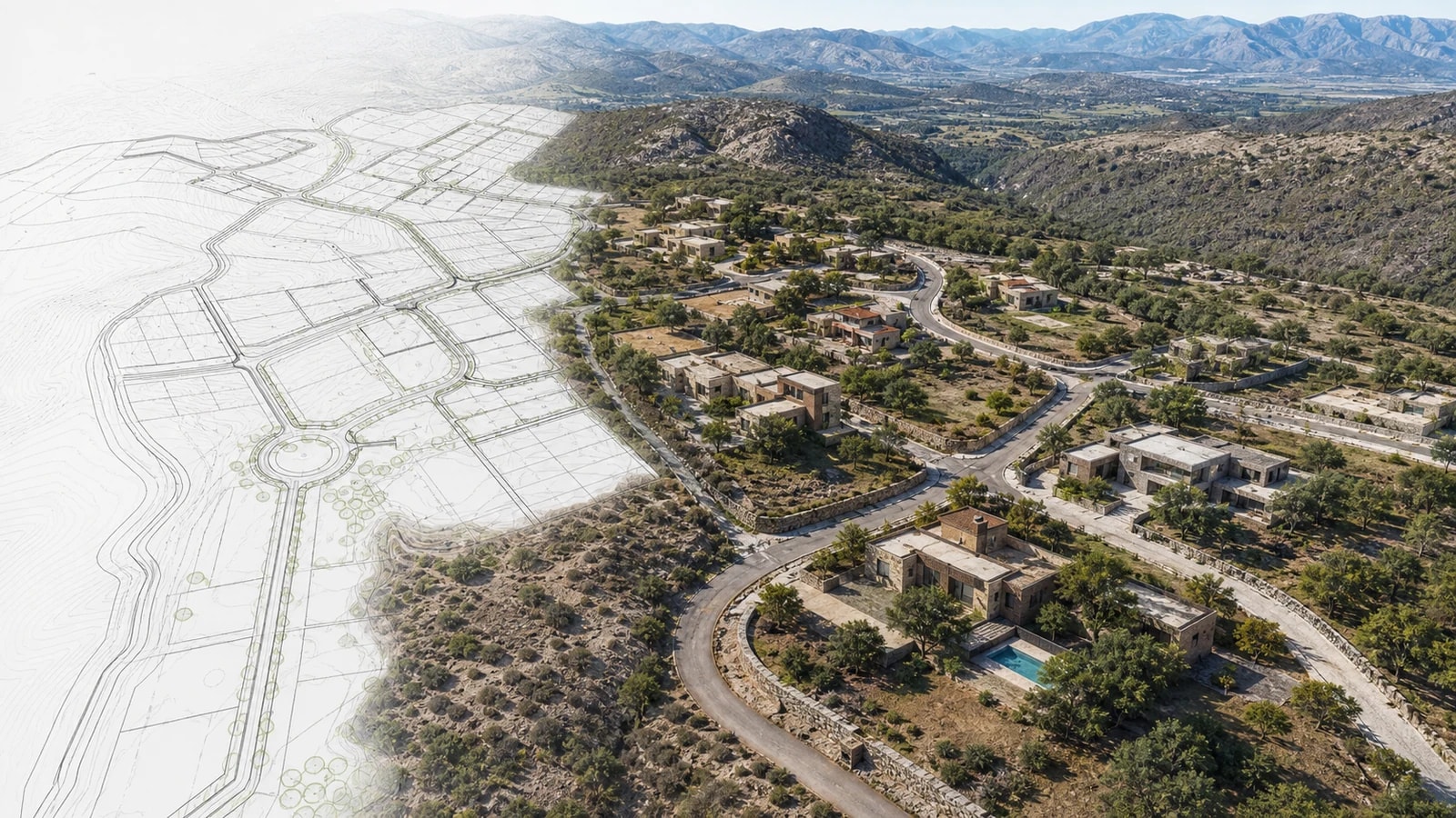
A top-down view keeps a stable hierarchy and makes positions, routes and overall layout easy to compare. It works in property sheets, websites, brochures, presentations and small screens where people review information at their own pace.
Its limitation is that it flattens terrain. Slopes, elevation and volumetric relationships may require symbols, sections or a complementary view.
When a 3D map adds value
Depth helps explain topography, volumes and the approach from the surrounding territory. It is useful in video when the camera moves from a regional view to a closer one, provided that motion does not hide entrances or landmarks.
Perspective does not certify boundaries, views, dimensions or heights. Future elements should be differentiated instead of appearing completed.
| Criterion | 2D map | 3D map | Recommendation |
|---|---|---|---|
| Primary question | Where every element is | How terrain and volume relate | Choose according to the buyer's question |
| Quick comprehension | High on mobile and in print | Depends on angle and detail | Test at the actual size |
| Access and routes | Clear for following journeys | Useful for an audiovisual approach | Combine overview and close-up |
| Topography | Requires contours, colors or symbols | Communicates depth intuitively | Do not exaggerate slopes |
| Amenities and phases | Compares areas consistently | Adds context and volume | Separate existing and proposed elements |
| Production | Fewer camera decisions | Requires perspective and pacing control | Prepare a script and storyboard |
| Best use | Property sheet, web, brochure and comparison | Video, presentation and launch | Create a hybrid system |
Match the format to the commercial stage
Discovery needs regional context; consideration needs access, services and layout; the decision stage requires property sheets, documents and an on-site visit. The channel also changes the piece: a property-portal image should not be designed like a vertical video, investor presentation or sales-office screen.
When showing travel times, state the origin, transportation mode and conditions used. An estimate provides context; it is not a guarantee of future mobility.
How to produce a map that informs and builds trust
Begin with coordinates, boundaries, approved names, roads, phases and landmarks. Build a readable static frame first, then add only the layers that support the primary question.
A specialized platform such as MapsAnimation supports animated 2D and 3D maps, terrain, buildings, camera movement, routes and markers. The tool supports production; accuracy still depends on the project's data and editorial review.
Checklist before publishing
- Confirm orientation, boundaries, entrances and current names.
- Separate existing elements from proposed or illustrative ones.
- Avoid exaggerating heights, slopes, distances and views.
- Test legibility at the smallest publication size.
- Use movement to support comprehension rather than spectacle.
- Provide a static or accessible version with essential information.
Use each representation for a different question
The 2D plan should support measurement of lots, streets, orientation, phases, amenities and restrictions. A 3D view helps explain volume, routes and spatial relationships, but it can hide distance or unbuilt elements. Label version, scale, north, status and date on both. A sales image should never replace the contractual plan.
Test the materials with someone unfamiliar with the project. Ask that person to locate the lot, travel from the entrance and distinguish existing work from proposals. Correct errors before publication. Connect map, availability and agreement through the same identifier without making the buyer guess at equivalence.